Hiking Project map of RVF:
Hiking Project is a crowd-sourced trail mapping website containing over 200,000 miles of trails from around the world. The Hiking Project app can be downloaded on your mobile device, which enables the user to see their current location in relation to the trails around them, a useful feature that makes navigation effortless. Users can select individual trails on the map to view the trail description, elevation profile, current conditions, ratings, and photos.
RVF Interactive Map:
This ArcGIS is another interactive map option for exploring the RVF trail system. This map also features direct links from specific sites of interest to relevant pages on the RVF webiste.
Special thanks to Cory Woods of Blue Ridge School for the creation of the Hiking Project and ArcGIS maps of RVF!
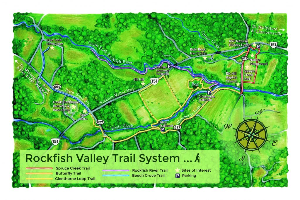
Illustrated RVF trail map:

Graphic design by Mihr Walden of Sylvan Graphics
Illustrated map of Spruce Creek Park:
RVF Kids Nature Trail MapAll Trails map of RVF:
All Trails is another crowd-sourced trail mapping service that includes RVF trails as well as those in the surrounding area, such as the Blue Ridge Parkway.

